GroundCAD is a 2D CAD software for the land surveying and civil engineering.
it runs on windows xp/7/8 and linux.
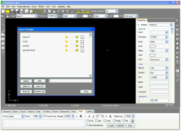
GroundCAD has a simple graphical interface to ensure the speed,simplicity
and the efficiency.
GroundCAD supports many standard formats like :
Ascii file(txt/csv),Autodesk dxf(ascii R12),Leica(gsi 8/16),Sokkia(sdr33)
Topcon(fc4/gts7/xml/landxml),Google(kml) ...
Please ,Test GroundCAD and send your comments to : [email protected]
Supported languages :
English.
Format drawing :
We use Drawing GroundcaD format DGD ,it is very simple format in ascii.
Drawing features :
Point with code comment.
Line.
Polyline.
Rectangle by 2 or 3 points.
Polygon.
Circle.
Style line solid,dot,dash.
Style hatch clear,solid,diagonal.
Modify thickness,color,hatch.
Snaping object :
Point.
Midline.
Endline.
Intersection.
Center.
Grid.
Texte features :
Font system.
Dynamic size.
Rotation.
Left.
Right.
Min Max size.
Spacing.
Labeling features :
Labeled point line polygon circle with
X Y Z.
X Y.
Z.
Name.
Code.
Length.
Azimuth.
Area.
Radius ...
Import and Export :
CSV and Text file for points.
Image format BMP,JPG,PNG.
DXF R12.
PDF.
SVG.
SDR 33 of Sokkia.
GSI 8 and 16 of Leica.
FC 4,GTS 7,XML,LandXML of Topcon.
it runs on windows xp/7/8 and linux.
GroundCAD has a simple graphical interface to ensure the speed,simplicity
and the efficiency.
GroundCAD supports many standard formats like :
Ascii file(txt/csv),Autodesk dxf(ascii R12),Leica(gsi 8/16),Sokkia(sdr33)
Topcon(fc4/gts7/xml/landxml),Google(kml) ...
Please ,Test GroundCAD and send your comments to : [email protected]
Supported languages :
English.
Format drawing :
We use Drawing GroundcaD format DGD ,it is very simple format in ascii.
Drawing features :
Point with code comment.
Line.
Polyline.
Rectangle by 2 or 3 points.
Polygon.
Circle.
Style line solid,dot,dash.
Style hatch clear,solid,diagonal.
Modify thickness,color,hatch.
Snaping object :
Point.
Midline.
Endline.
Intersection.
Center.
Grid.
Texte features :
Font system.
Dynamic size.
Rotation.
Left.
Right.
Min Max size.
Spacing.
Labeling features :
Labeled point line polygon circle with
X Y Z.
X Y.
Z.
Name.
Code.
Length.
Azimuth.
Area.
Radius ...
Import and Export :
CSV and Text file for points.
Image format BMP,JPG,PNG.
DXF R12.
PDF.
SVG.
SDR 33 of Sokkia.
GSI 8 and 16 of Leica.
FC 4,GTS 7,XML,LandXML of Topcon.
